Estimating Distance Off
By Dick Everitt for USBOAT
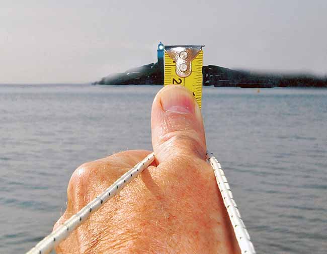
Got a tape measure and a piece of string? You can use them to find out how far away you are from, say, a lighthouse.
Distance off by vertical sextant angle is an old navigation technique used for keeping a safe distance from an object of known height, such as a lighthouse, the height of which is shown on a chart. With modern GPS, there's no longer need to know how to calculate this, but it's a fun trick to show the kids, and it's a useful backup if you're ever forced to use basic navigation techniques. But as many of us don't carry a sextant, or a set of tables, we can copy what the ancients had been doing for centuries before the sextant was invented. They simply exploited their knowledge that the ratio of 60:1 is equal to an angle of 1 degree. To find this distance, simply measure the angle of the center of the light above sea level and look up the "distance off" in a set of tables, such as those found in a nautical almanac, or use a simple calculation (below). The center of the light itself, not the height of the top of the tower, is used because that's the height marked on the chart. Usually we can forget any tidal height allowance, as less tide will put us farther off in safer water.
In its simplest form, you'll use something that measures 60 units from your eye attached to a vertical ruler marked in the same units. (Using a metric rule to do this exercise makes your math calculation simpler because you can work in whole numbers instead of fractions.)
Hold a piece of string 60 cm (about 2 feet) in front of your eye. (I find a loop of string of the correct length around my neck more comfortable than holding a knot in my teeth.) Sight across the ruler and measure the height of the center of the light above sea level, in millimeters. Then use the formula below.
It's a rough-and-ready technique, but one day it might save you being set in too close to a nasty reef or rocks.