BASED ON AN ARTICLE FROM The Annapolis Book of Seamanship
Reading Clouds
Learning what clouds can tell us is a useful skill that will help decide if it's safe to head out for a grand day on the water or weather a storm in port.
Weather forecasts are very important, and so is a barometer, but you can also get a reliable gauge on your local weather if you think of the sky as something like the face of an emotional person whose moods are shown right on his or her face.
Reliable indicators are the changing shape and color of the clouds, which are created by the same natural phenomena that cause the weather itself: temperature and humidity. Here are some hints for predicting weather by reading clouds.
Isolated, wispy, or very high clouds are an indication of fair weather.
Crowded, dense, dark, and towering clouds indicate changing or worsening weather.
The sharper the edge of a thundercloud and the darker its color, the more violence it may contain. Don't go below or near it.
If cloud color, shape, and size change, so will the weather.
As puffy cumulus clouds darken, enlarge, and become dark cumulonimbus clouds, expect squalls within two hours.
Cirrus
The highest and least-substantial clouds. Composed of ice crystals, cirrus clouds lie at altitudes of about 45,000 feet. Wispy and lying at oblique angles, these clouds may herald the approach of a warm front.
Cirrostratus
Wispy clouds lying in sheets may form a ceiling slightly lower than cirrus clouds as a warm front nears and layers of cold air mix with upper warm air. May drape the entire sky in a gray haze and cause a halo around the sun or moon — an indication of a nearing storm.
Cirrocumulus
Have barely-defined puffy balls and, like cirrostratus, lie at altitudes of 16,500 to 40,000 feet, usually in large clumps. From below, these clouds may look like fish scales. The saying "mackerel sky mackerel sky, not long wet, not long dry" describes them and the changeable weather that follows.
Altostratus
Sheets of cloud between 6,000 and 23,000 feet. Thicker, darker and more claustrophobic than the higher cirrostratus clouds, they promise rain soon.
Altocumulus
These have grayish-white rolls that look like cirrocumulus but are darker and sometimes appear in layers. If the wind is steady between northeast and south, these clouds promise rain soon.
Stratocumulus
Large, dark, puffy balls occurring in compressed layers and foretell bad weather.
Cumulus
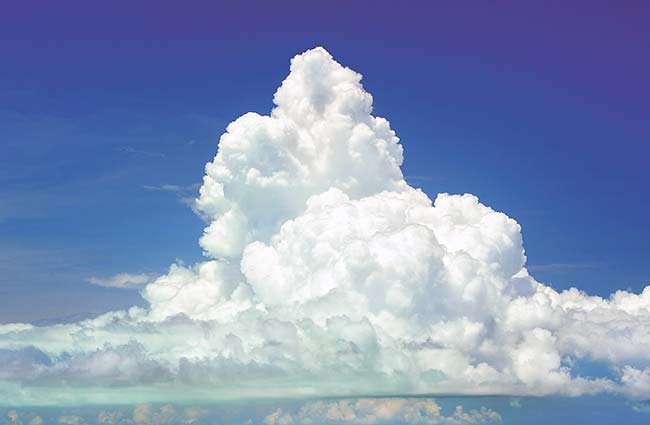
Puffy white cotton balls at about 6,000 feet promise fair weather. They may, however, darken and be transformed into stratocumulus or cumulonimbus clouds, which can signal bad weather. Seen over land during the day indicates thermals and promises good sea breezes.
Cumulonimbus
Dark, tightly-packed balls that may churn and tower as thunderheads at about 6,000 feet. If broader above than below, it's called an anvil head. This shape is due to violent updrafts through a wide range of temperatures. As the updraft hits, cold air is condensed as a cloud. Winds are strong around these threatening clouds.
Nimbostratus
Heavy, rain-laden, low-lying, dark gray blankets that come with warm fronts and wet nor'easters. Their soggy bases may be just above the earth's surface and be indistinguishable from heavy fog.
Stratus
These clouds combine in a dense gray overcast that promises light to heavy rain.